Our Products
At ZaminSense, we implement comprehensive smart environment solutions using various sensors and data collection platforms including UAVs and satellites. Our three core solution areas are ForestSense, WaterSense, and WetlandSense.
ForestSense
ForestSense delivers comprehensive forest monitoring across landscapes such as New York State, integrating satellite, airborne, and drone data to map forest cover, model biomass, and detect health changes driven by pests, disease, and climate stressors. These insights enable sustainable forest management, conservation planning, and robust carbon accounting.
AiDroneTree: An AI-Based Software for Individual Tree Detection and Forest Inventory Using UAV LiDAR Data
At the heart of our ForestSense platform, AiDroneTree transforms drone-based LiDAR and imagery into detailed per-tree analytics, measuring height, crown area, biomass, and carbon. It’s powered by TreeNet, our proprietary deep learning engine, currently under provisional patent through the SUNY Research Foundation.
AiDroneTree serves a diverse range of customers across government, environmental, and private sectors who require accurate, scalable, and cost-effective tree-level data at large scale. Some of the potential customers include: Drone service providers, Timber and forestry companies, Urban planners, landscape architects, and green space managers, Environmental consulting and carbon offset firms, Municipalities and urban forestry departments, and Government agencies (e.g., US Forest Service).
ForestNet
WaterSense
WaterSense focuses on freshwater systems like the Finger Lakes Region, where high-resolution satellite imagery, drone surveys, and field measurements are combined to assess turbidity, chlorophyll-a, nutrient loading, and harmful algal blooms (HABs), empowering stakeholders to safeguard water quality and respond rapidly to environmental threats.
Water Quality Monitoring of Canandaigua Lake through Remote Sensing and Machin Learning
Decadal mapping of the Lake’s SDD and Chlorophyl-a concentration
Machine learning methods trained on field data collected
– NY DEC- Citizen Statewide Lake Assessment Program (CSLAP)
– Canandaigua Lake Watershed Association (CLWA) Citizen Science Program
– Skaneateles Lake Association (SLA) Citizen Science Program
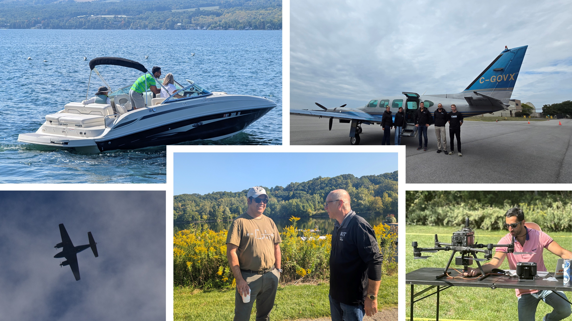
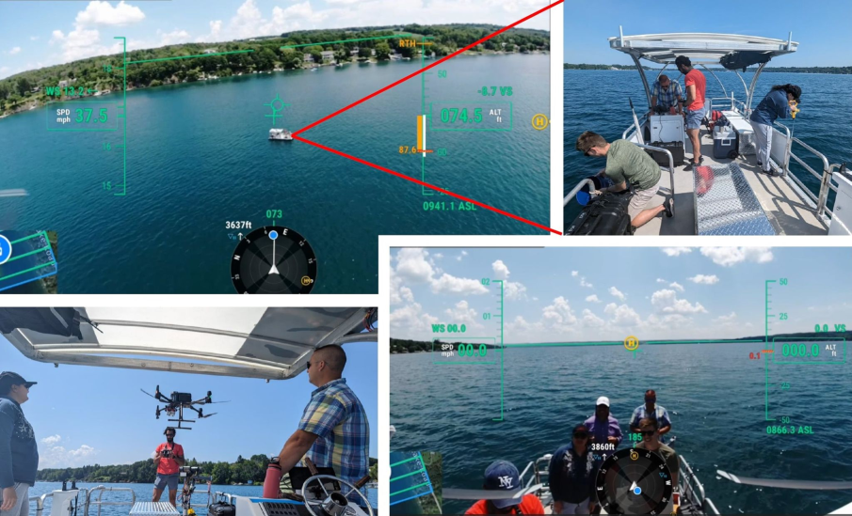
A cohort of data collected by Satellite, Drone, and Boat, Concurrently
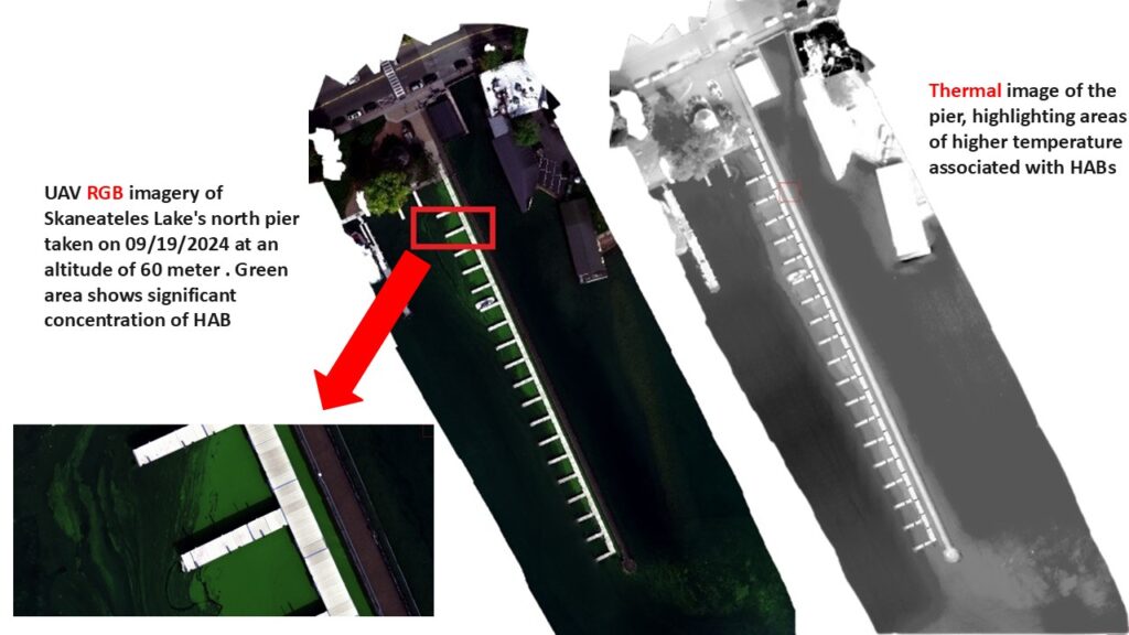
Drone/Satellite imaging of HAB
Finding the extent of lake’s foam using RADAR imagery
Invasive species detection using Hyperspectral drone
Water Quality and Algal Bloom Monitoring of Skaneateles Lake through Remote Sensing and Machin Learning
Foam Detection using RADAR Satellite
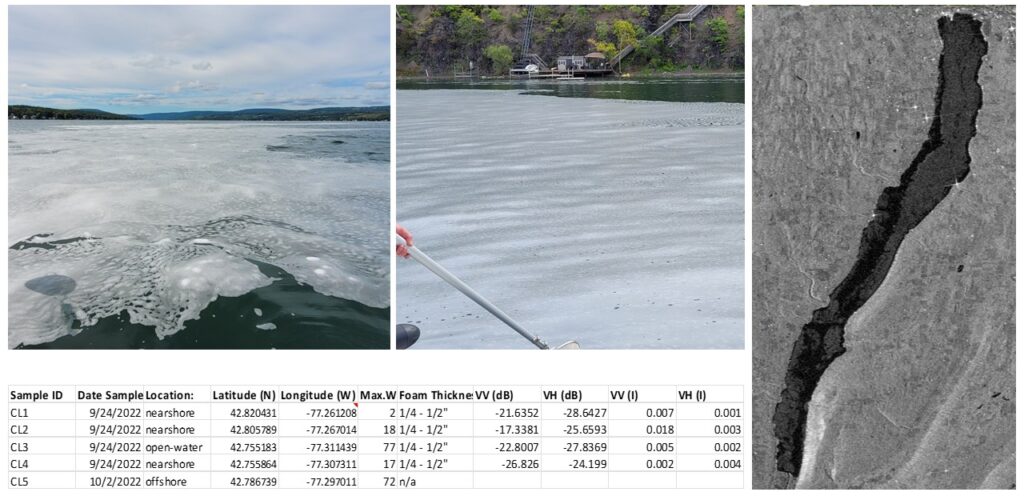
The figure shows a Sentinel-1 SAR image in VV polarization, captured on September 24, 2022, at 6 PM local time (one of the dates when significant foam observed) . The foam is easily detectable in the VV imagery due to its microtopography on the water’s surface — the dark areas represent water without foam, and the gray areas indicate foam coverage. It appears that foam covers the majority of the lake, particularly the northern part.
This confirms that SAR can effectively detect the extent of foam on the lake, even with full cloud cover.
WetlandSense
WetlandSense provides high-accuracy wetland delineation, classification, and seasonal change detection through multi-sensor remote sensing, supporting regulatory compliance, ecosystem restoration, and long-term protection of wetland habitats.
ARSenAL: Advanced Remote Sensing Applied Lab
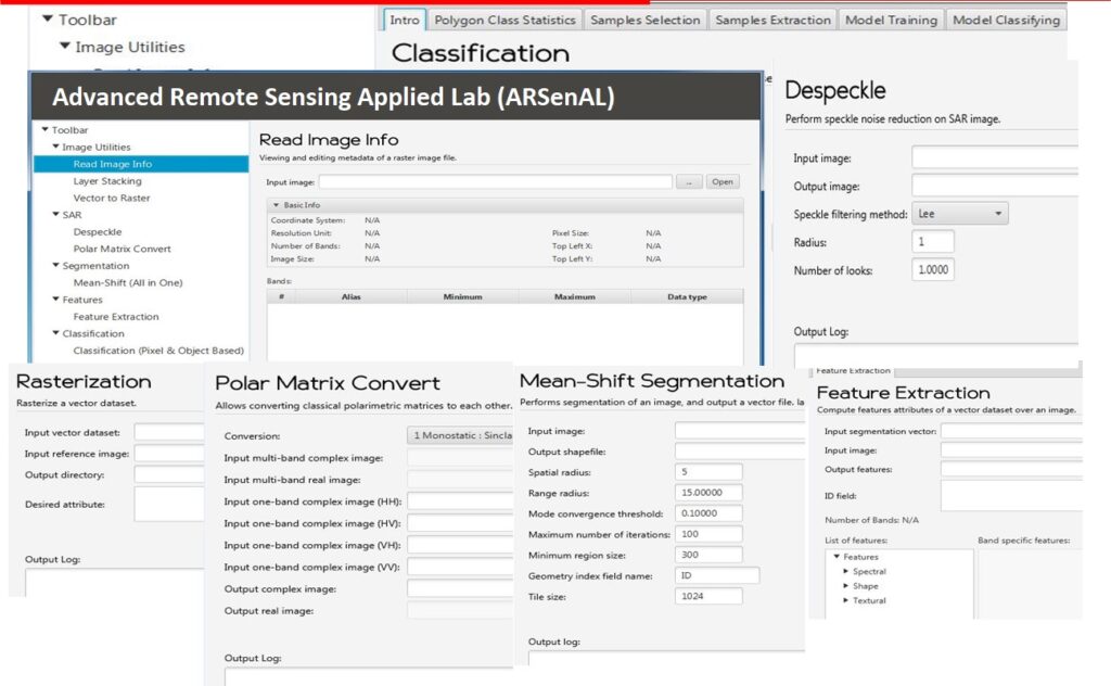
ARSenAL is an advanced remote sensing toolbox, developed by Dr. Salehi and his team, comprising several algorithms for processing SAR and optical imagery. Algorithms include Segmentation, Feature Extraction (Spectral and Textural), Object-based Random Forest Classification, SAR speckle filtering and decomposition, a genetic-based feature extraction for random forest classification of wetlands, etc.